Hopefully this will be the start of more regular updates here. But websites are sort of a waste of time, no?
Hopefully this will be the start of more regular updates here. But websites are sort of a waste of time, no?

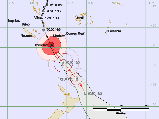
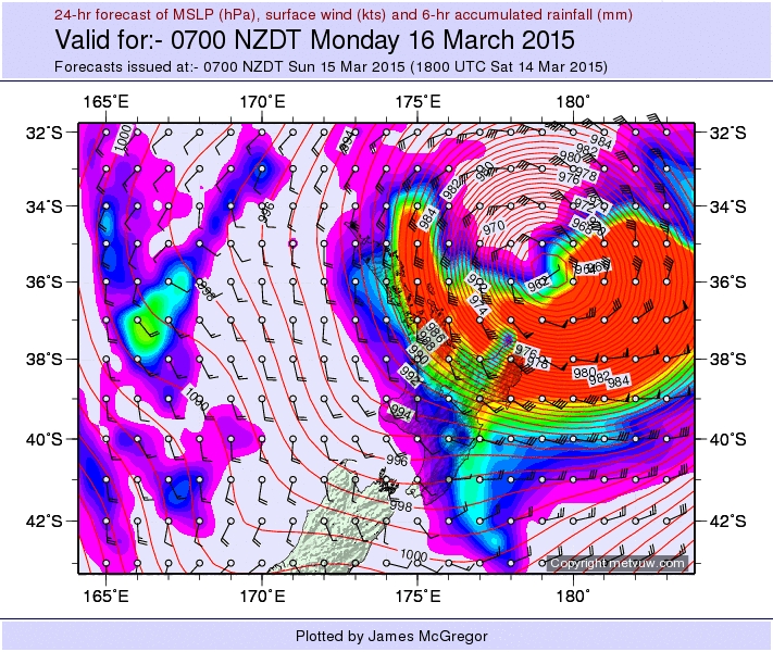
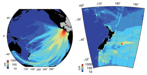
Have been watching Cyclone Pam since she first started forming about a week ago up in the tropics. After seeing the track move east and west relative to New Zealand, we are now in the final stages of the storm’s approach and it seems like the center of the storm will pass within 150 km of the East Cape of New Zealand. Recent forecast track maps are pasted below.
We shouldn’t see very much over here on the West Coast of New Zealand, but my partner’s family is in Gisborne on the East Coast, right on the beach facing in to the 50 knot south easterlies and 30 ft seas. Could be gnarly for them and we are simply hoping for the best.
From Fiji Met Service, valid at 2:17 AM NZDT Sunday 15 March.
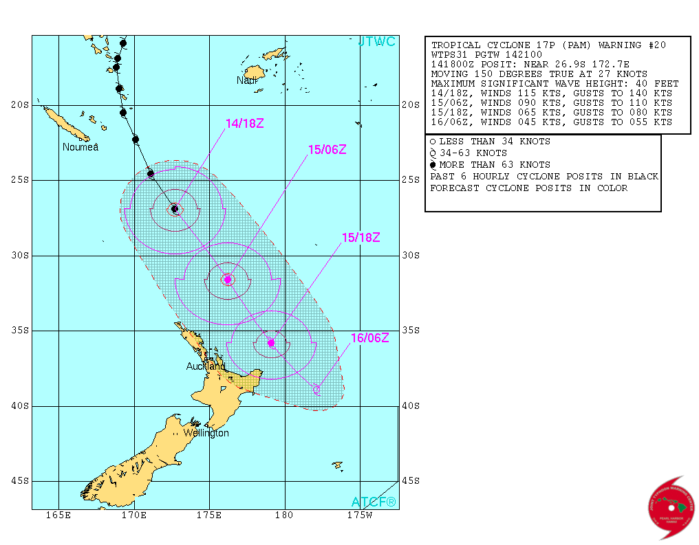
Forecast track map from JTWC (US Navy) as of 0700 NZDT Sunday March 15, 2015
Buoyweather.com marine forecast for offshore Gisborne (39 S 178.5 E).
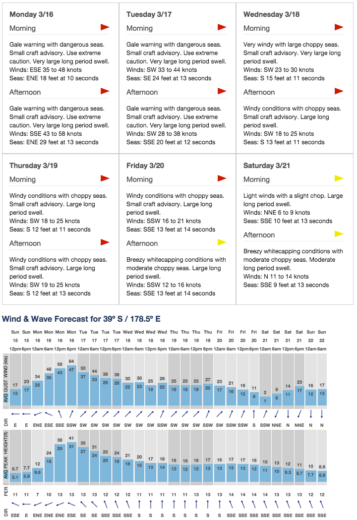
Rain and wind forecast
1) Our edited volume “Tsunamis in the Pacific Ocean: 2011 – 2012” has been published in print in the Journal Pure and Applied Geophysics (PAGEOPH).
2) My most recent paper on tsunami hazards in New Zealand was also published in PAGEOPH “Far-field tsunami hazards in New Zealand ports”
3) A paper I was co-author on was published in PLOS One: Plastic Pollution in the World’s Oceans: More than 5 Trillion Plastic Pieces Weighing over 250,000 Tons Afloat at Sea
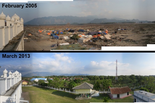
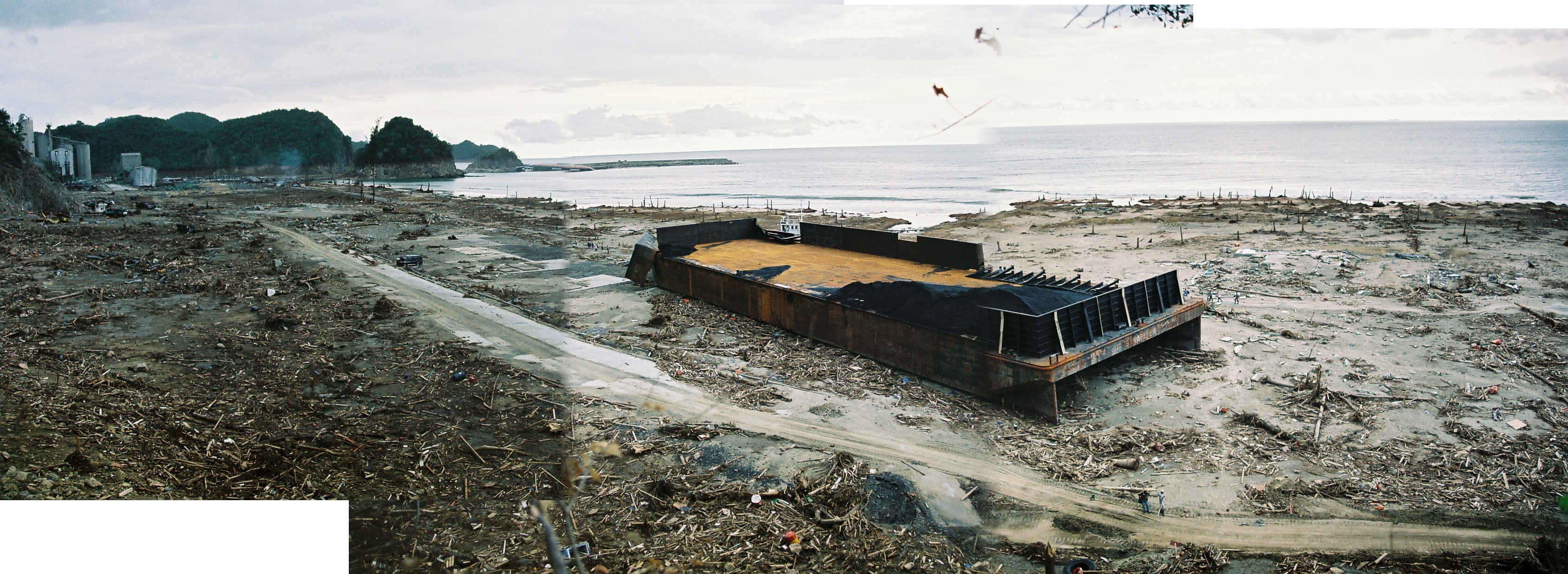
Below are a few examples of what Banda Aceh looked like immediately after the tsunami compared to what it looks like today. I had the pleasure of returning to the city in March 2013 to work on a documentary for National Geographic where we discussed the great 2004 tsunami and looked at how the city has recovered since the tsunami. Besides these images, I have uploaded all of the photos I took in Banda Aceh during my first field survey of the tsunami 1 week after the event.
In this image I am standing on top of the mosque at Lampu’uk near Lhok Nga, located to the west of Banda Aceh. After the tsunami the mosque was the only intact structure for kilometers in every direction.
[slideshow_deploy id=’753′]
Above is the ‘boat on the house’ this was an enduring image from Banda Aceh. One of my photos from this site even became the cover of a textbook. Since the tsunami they have made this site in to a museum as a way to remind people about tsunami disasters.
[slideshow_deploy id=’764′]
In this slide show, we are at the village of Lampisang, located about half way between Banda Aceh and the west coast where the tsunami was the largest. The interesting thing about this site was that the tsunami attacked from two directions, the direct tsunami surge advancing from the west and the tsunami surge approaching from the north after it had wrapped around the northern tip of Sumatra and flowed through Banda Aceh. These photos were taken at the location of the ‘1.5’ in the last image of the slide show (reproduced from my article in Science Magazine – get it free with registration at the link)
[slideshow_deploy id=’771′]
My final slide show is from a bridge near the center of Banda Aceh. The tsunami surge from the north came up the river, pushing with it all of the accumulated debris from several kilometers of the city. The bridge acted as a barrier causing a large amount of debris to pile up. That bridge has since been repaired and is still in use.
I have recently uploaded the complete set of photographs I took during the first field survey of Banda Aceh and surrounding areas just one week after the 2004 Indian Ocean Tsunami.
See the full set of photos here.
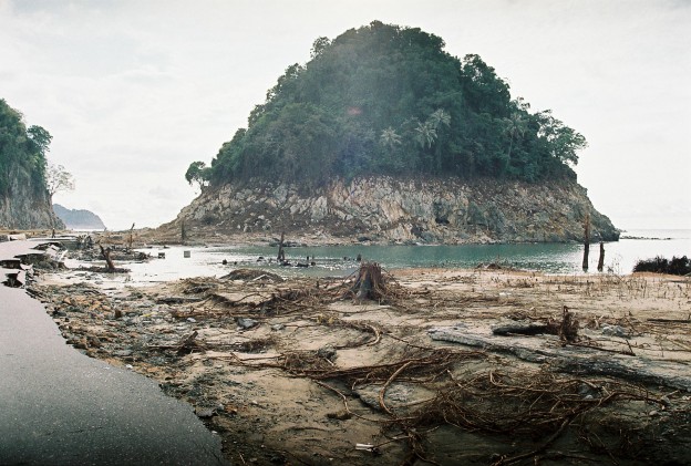
Lhok Nga, west of Banda Aceh, 10 days after the tsunami.
[slideshow_deploy id=’706′]
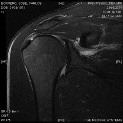
The imagery of my shoulder. Click on one of the links below to go to a separate web page with the series of images for each view. Each link opens in a separate window. You will then see all of the images from that view at small size. Click on the first image (top left) and you will see above it a ‘next’ link. Click on that and you will see the next image in the series. You can go through each of the images in each series that way.
22 March 2014, 0900-1000 hrs NZDT
TIDE: 8:23 am low (0.6 m), 14:44 pm high (2.9 m)
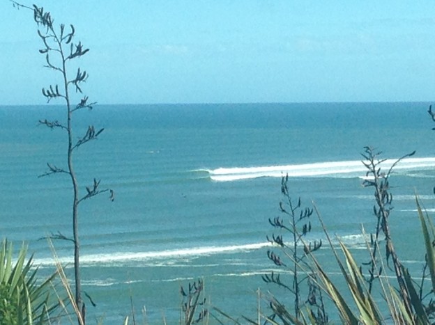
Just before 9 am NZDT March 22, 2014, I was at the Michael Hope Lookout over Ngaranui Beach. I was watching the swell break over the Raglan Bar. The swell was very clean with an easterly wind. Low tide according to the MetService was 0.6 m at 8:23 am. Two boats were anchored well clear of the south side of The Bar, and there were a handful of surfers plus three stand up paddle-boarders catching well formed right handers breaking there. I also noticed some very fast, clean left-handers breaking along the northern flank of The Bar.
My friend Ed Atkin, who is also a member of the local volunteer Raglan Coastguard (RCG), drove up and parked next to me as we watched the waves. At that time, we noticed a fishing boat trying to get out across the bar. The boat was trying to traverse the northern flank (the left hander). When we first noticed the boat, it was facing in towards the Harbour, like it had tried to cross and turned back. It then turned back around and tried to head out during a lull in the swells.
As it crossed, I could see a wave peeling down the sand bank towards the boat, it was not one of the bigger waves that day. That first wave hit the boat as a bore (whitewater) and the vessel stayed upright but lost all forward speed. It started moving again, trying to make it across as another, slightly larger wave was breaking down the bank. This wave broke just outside of the boat’s position and hit the boat nearly immediately afterward. The boat was capsized and several people could be seen in the water.
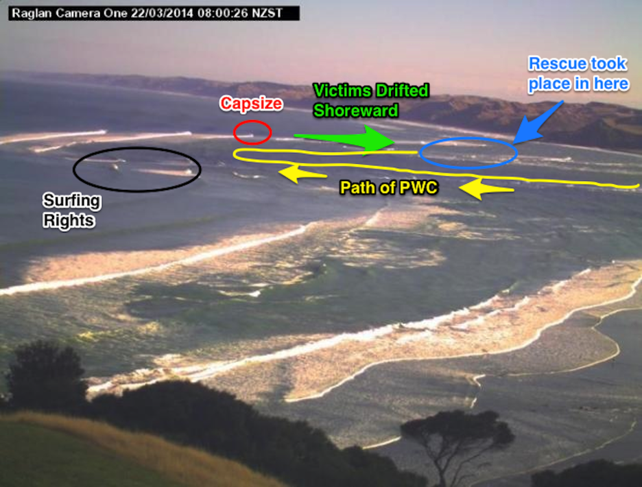
The image above shows a snapshot of the Raglan Bar taken this morning at 8 am by the NIWA cam-era system. This was approximately 1 hr before the incident. I have superimposed the approximate location of where things happened.
Ed immediately called his colleagues at the Coastguard and departed to go to the station at the Raglan Wharf and take part in the rescue. I stayed at the lookout to maintain visual contact with the boat and the victims.
In a very short amount of time, the boat and the cluster of victims were separated by 10’s of meters. The victims appeared to be staying together. At first I thought there were 5 or 6 people, but later it seemed there were only 4. However, I am not entirely sure. The current was pushing them along the shallows just inside the northern flank of The Bar. I started my stopwatch about 5 minutes after the event to keep track of time as things unfolded.
Approximately 20 minutes after they capsized, I first noted the Raglan Coastguard’s (RCG) Personal Water Craft (PWC) coming out of the harbor entrance. They sped out towards the location where the boat capsized, but apparently could not see the boat or victims since they passed by them. The PWC reached the approximate location where the boat capsized and turned to the right, following the current and the wave breaker line shoreward. They quickly made visual contact with the boat, and then the victims. The PWC reached the victims ~25 minutes after the boat capsized.
During this, I noted the Surf Lifesaving (SL) speedboat being towed along the beach by a quad-bike, heading toward the harbor entrance to launch from flat water and assist in the rescue. Also, the larger Coastguard boat was by now also just making its way out of the harbor entrance.
The PWC appeared to pick up two victims and was heading across in towards the center of the main harbor channel as the larger coastguard boat headed in along the main channel towards their location.
Both the larger Coastguard vessel and the Surf Lifesaving speedboat initially went out past the location of the victims and turned around. As the PWC was coming in to meet the CG boat, the Surf Lifesaving speedboat had gotten approximately to the capsize location and turned around, following the breaker line shoreward. They quickly made contact with the capsized vessel and then with the victims. The SL speedboat reached the remaining victims as the PWC was returning to that location.
At this time the large Coastguard vessel was motoring in towards the entrance of the harbor, the PWC and the speedboat were next to each other. The PWC departed towards the large Coastguard vessel as the speedboat continued shoreward in the shallows. The victims appeared to be on the SL Speedboat.
All of the vessels then gathered at the entrance to the harbor. At this time I lost visual contact with the action as the flotilla drifted into the harbor and out of my line of sight. This was ~40 minutes after the initial incident.
Two articles I have been working on over the past few months have recently been published in the academic journals ‘Pure and Applied Geophysics’ and ‘Geophysical Research Letters’.
The first article “Observations and Modeling of the August 27, 2012 Earthquake and Tsunami affecting El Salvador and Nicaragua” (Pure and Applied Geophysics, DOI 10.1007/s00024-014-0782-2) discusses how a relatively weak earthquake generated a surprisingly large tsunami with maximum heights of the order of 6 m and inundation distances over 100 m. Fortunately, this tsunami was focused on an unpopulated stretch of coastline and there were very few injuries and no deaths. The only injuries were sustained by a group of people who happened to be on the beach late in the evening when the earthquake and tsunami struck. (I previously reported on this event in a blog post following our field survey to the disaster area).
This event underscores the hazard posed by a special type of ‘slow earthquake’ known to occur along the Central America Trench. In 1992, some 160 km to the south, offshore of Nicaragua, a somewhat larger earthquake with similar characteristics to this event produced a tsunami wave of over 10 m, killing several hundred people.
The second publication “Assessment of the tsunami-induced current hazard” (Geophysical Research Letters, DOI 10.1002/2013GL058680) details our work at the University of Southern California Tsunami Research Center focused on the quantification of tsunami induced currents and maritime tsunami hazards. While most tsunami research until recently has focused on inundation and coastal flooding as a primary cause of damage, observations from recent and historical tsunamis show that significant damage and effects occur frequently in ports and harbors even though there is no overland flooding. Of course this in itself is not totally noteworthy, however, relating tsunami induced current speeds to levels of damage within a port or marina and quantifying these effects with numerical models has not been done before. For this study we relied on our catalog of tsunami damage and current speed recorded at sites throughout the Pacific Ocean that were affected by the 2009 Samoa, 2010 Chile and 2011 Japan Tsunamis.
I am very grateful to my co-authors and collaborators on both of these papers for all of the hard work in getting them published.

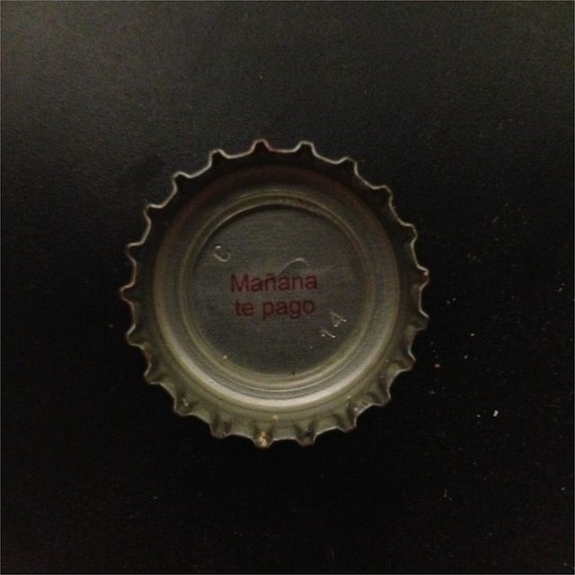
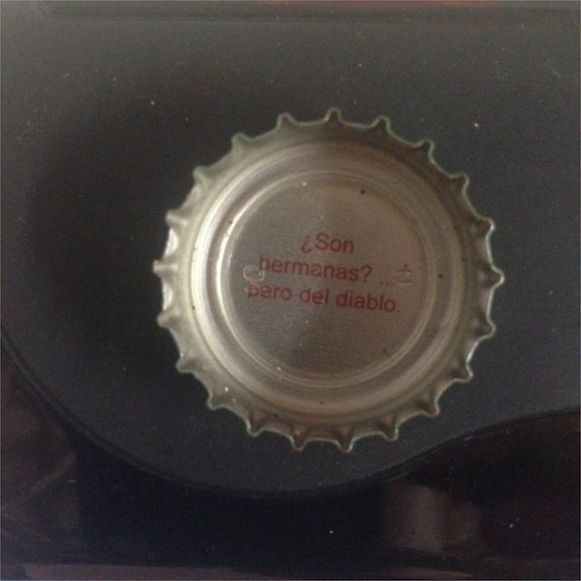
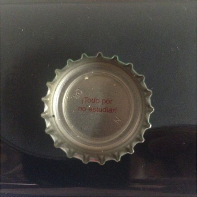
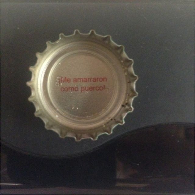
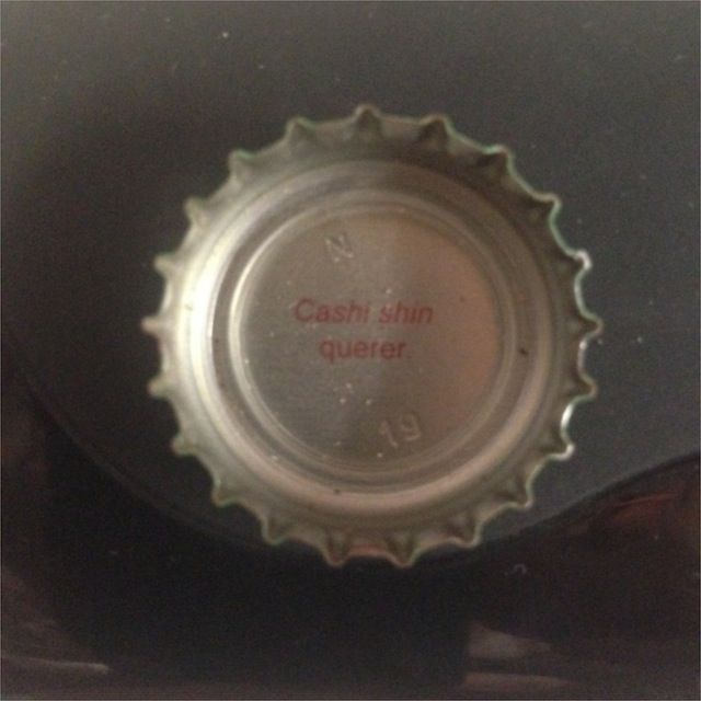
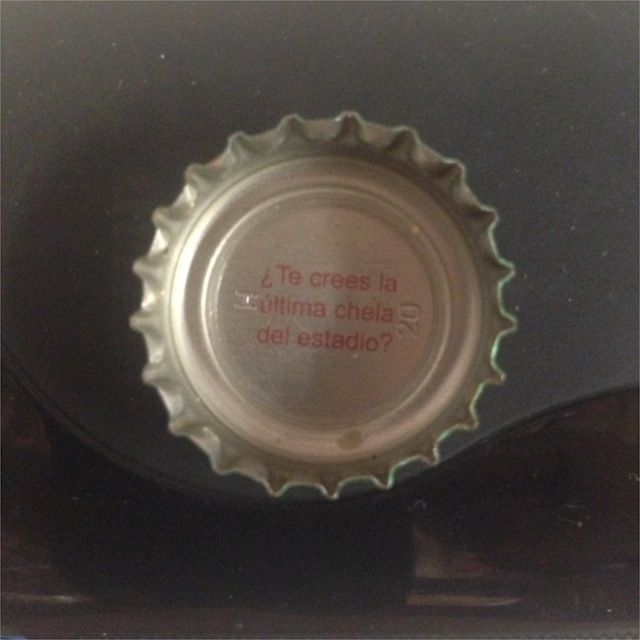
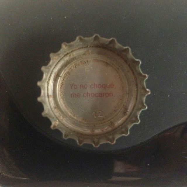
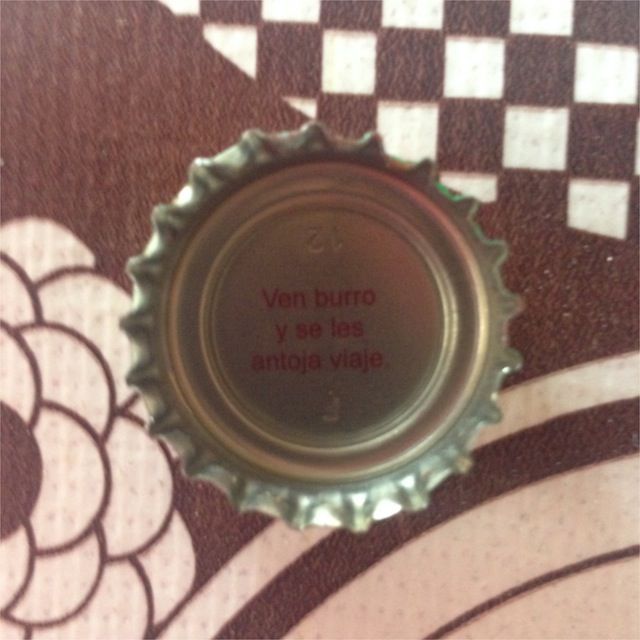
While in Guerrero, Mexico a few months ago (October 2014), it was hot and we drank a lot of beer. Mostly Victoria (I prefer it to Corona). At the time they were running a marketing campaign called ‘Pretextos para Llevar’ which means something like ‘Excuses To Go’. Under each bottle cap was a saying which was a sort of ‘excuse’ for something, I am not sure what.
I must say I did not fully understand the jokes, some were obvious, but others not so much. Regardless, it was kind of a fun way to learn some more colloquial Spanish from Mexico, the kind of stuff you don’t learn in classes… I think the fact that I was raised 90% in English and learned most of my jokes/sayings/colloquialisms from Puerto-Rican culture has hindered my ability to get these sayings, but then again maybe they are just stupid!
I took some pictures of the bottle caps and they are below. Tell me which one is your favorite and why?


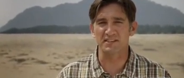
In March, 2013 I traveled to Banda Aceh, Sumatra to film a segment for a National Geographic Television documentary entitled ‘Top Ten Natural Disasters’. The segment I was featured in focused on the 2004 Indian Ocean tsunami. This was the first time I had been back to Banda Aceh since immediately after the tsunami in 2004 and on a follow up survey in early 2005. I first posted about this trip in an earlier news item.
Well the program finally aired in the USA and I was able to get a copy of my segment. I have cut my parts together in to a 4 minute segment below. It is also accessible through the links on my media page. Working on this program was a great experience, it was produced by Pioneer Productions from the UK, a company that specializes in high end science and educational television. A lot of what you see on Discovery or National Geographic is produced by the folks at Pioneer. The show was directed by Jeremy Turner who is also very experienced in these sorts of productions. We shot a lot more than what ended up in the final cut (of course!!), but nevertheless, I am very happy with what they ultimately produced.