Below are a few examples of what Banda Aceh looked like immediately after the tsunami compared to what it looks like today. I had the pleasure of returning to the city in March 2013 to work on a documentary for National Geographic where we discussed the great 2004 tsunami and looked at how the city has recovered since the tsunami. Besides these images, I have uploaded all of the photos I took in Banda Aceh during my first field survey of the tsunami 1 week after the event.
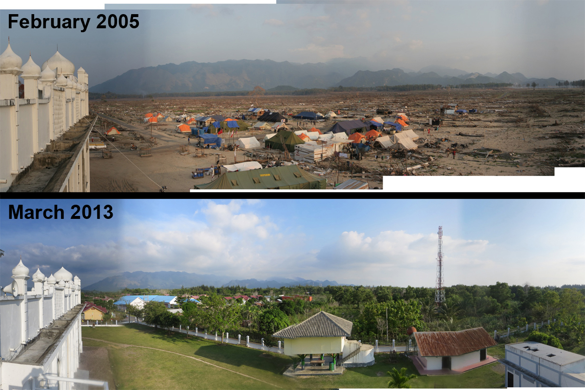
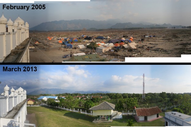
In this image I am standing on top of the mosque at Lampu’uk near Lhok Nga, located to the west of Banda Aceh. After the tsunami the mosque was the only intact structure for kilometers in every direction.
[slideshow_deploy id=’753′]
Above is the ‘boat on the house’ this was an enduring image from Banda Aceh. One of my photos from this site even became the cover of a textbook. Since the tsunami they have made this site in to a museum as a way to remind people about tsunami disasters.
[slideshow_deploy id=’764′]
In this slide show, we are at the village of Lampisang, located about half way between Banda Aceh and the west coast where the tsunami was the largest. The interesting thing about this site was that the tsunami attacked from two directions, the direct tsunami surge advancing from the west and the tsunami surge approaching from the north after it had wrapped around the northern tip of Sumatra and flowed through Banda Aceh. These photos were taken at the location of the ‘1.5’ in the last image of the slide show (reproduced from my article in Science Magazine – get it free with registration at the link)
[slideshow_deploy id=’771′]
My final slide show is from a bridge near the center of Banda Aceh. The tsunami surge from the north came up the river, pushing with it all of the accumulated debris from several kilometers of the city. The bridge acted as a barrier causing a large amount of debris to pile up. That bridge has since been repaired and is still in use.